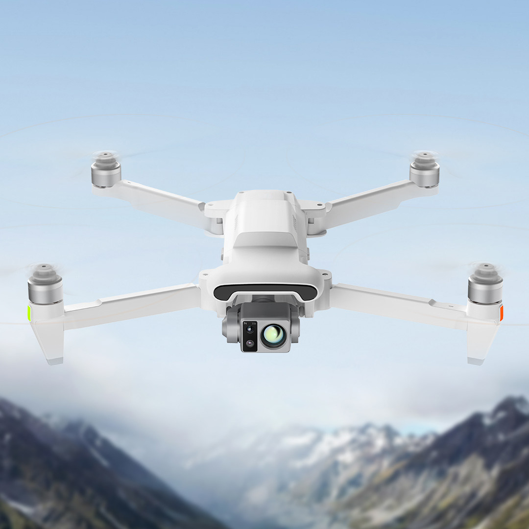
FOVA X8 Thermal
Mini Unmanned Aerial
l Takeoff Weight 1025g
l Max.Flight Time 47 min
l Wheelbase 372 mm
l Max.Flight Speed 18 m/s
Parameters
| Aircraft |
| Folding Body Size | 204*106*72.6 mm (Without paddle) |
| Expanded Body Size | 242*334*72.6 mm (Without paddle) |
| Bare Weight | 855 g |
| Take-off Weight | 1205 9 |
| Wheelbase | 372 mm |
| Max. Ascent Speed | 5 m/s |
| Max. Descent Speed | 4 m/s |
| Max. Flight Speed | 18 m/s |
| Max. Takeoff Altitude | <6000 m |
| Max. Flight Time | 47 min |
| Max. Range | 33km |
| Max. Wind Rating | Level 7 |
| Operating Temperature | -10~40°C |
| GNSS | GPS+GLONASS+BeiDou+Galileo |
| Expansion Joint | 12-PIN Data Connector (Female) |
| Hovering Accuracy | Vertically ±0.1 m / +0.5 m,Horizontal ±0.3 m / ±0.5 m |
| Wide Angle Camera |
| Image SensorsDigital Zoom | 1/2-inch CMOS, 48 megapixels |
| Digital Zoom | 1~5X |
| Camera Lens | FOV 79° |
| Aperture | F/1.6 |
| Camera Focus | 4.71 mm |
| Equivalent Focal Length | 24 mm |
| Depth | 1 m to infinity |
| IS0 Scope | Video 100-26500, photos 100-6400 |
| Shutter Speed | 1/8000 sec. to 2 sec |
| Effective Pixel | 48 million |
| Max. lmage Size | 8064*6048 |
| Max. Video Resolution | 3840*2160@30fps |
| Video Max. Bitrate | 100 Mbps |
| Video Format | MP4 |
| lmage Format | JPEG / DNG |
| Infrared Thermal Imaging Sensor |
| Pixel pitch | 12 microns |
| Video Resolution | 640*480@30fps |
| Focal length | 19mm |
| Equivalent Focal Length | 80 mm |
| DFOV | 30.7° |
| Aperture | F11 |
| Focusing Distance | 5 m to infinity |
| Palette | White Heat / Black Heat / Jungle /lron Red / Rainbow / Aurora Borealis /Shimmer / Glow Gold / Red Heat /Medical / Gold Red |
| Long Focus Camera |
| lmage Sensors | 1/2.5-inch CMOS |
| Digital Zoom | 5-30X |
| Camera Lens | FOV 21.5° |
| Aperture | F/3.0 |
| Camera Focus | 14.46 mm |
| Equivalent Focal Length | 120 mm |
| Depth | 10 m to infinity |
| Effective Pixel | 12 million |
| IS0 Scope | Video 100-6400, photos 100-6400 |
| Shutter Speed | 1/8000 sec. to 2 sec. |
| Max. lmage Size | 4000*3000 |
| Max. Video Resolution | 3840*2160@30fps |
| Video Max. Bitrate | 100 Mbps |
| Video Format | MP4 |
| lmage Format | JPEG / DNG |
| File System | FAT32 / exFAT |
| Long Life Edition Smart Battery |
| Capacity | 5000 mAh≈333 g |
| Weights | 14.4 V |
| Rated Voltage | 16.8 V |
| Charge Limit Voltage | Li-ion 4S |
| Battery Type | 72wh |
| Energy | 0~40°C |
| Charging EnvironmentTemperature | 5000 mAh≈333 g |
| Payload |
| Three-axis Structure Range | -115°~40° (Pitch),-40°~40° (Roll) -40°~40° (Heading) |
| Rotation Range | 10°~-90° (Pitch) |
| Angular Momentum Range | ±0.005° |
FOVA X8 Series: Extended Flight for Advanced Operations
The FOVA X8 Thermal and X8 Tele Max are professional-grade multi-rotor drones engineered for advanced data collection and demanding tasks. They feature an impressive maximum flight time of 47 minutes 1, a significant endurance for a multi-rotor platform, enabling comprehensive data capture without frequent interruptions. This extended flight time, combined with their sophisticated multi-sensor camera systems (including wide-angle, telephoto, and thermal imaging capabilities 1), allows for more thorough inspections, longer search and rescue operations, or sustained surveillance.
Professional missions, such as detailed infrastructure inspections, search and rescue in complex terrains, or long-range surveillance, are often time-sensitive and data-intensive. Longer flight times mean fewer battery swaps and landings, which directly translates to more continuous data capture, reduced risk of missing critical events, and overall higher operational efficiency. Advanced sensors themselves often require substantial power, and extended flight times ensure these high-demand payloads can be effectively utilized for longer durations, yielding more comprehensive datasets. The X8 series also features a robust design, capable of operating at high altitudes (X8 Thermal max takeoff altitude <6000m, X8 Tele Max ≤5000m) and in strong winds (X8 Thermal max wind rating Class 7, X8 Tele Max max wind speed 12m/s).1 The X8 series' endurance translates into greater operational efficiency, reduced mission downtime, and the ability to gather more critical data per flight.
Product Description:
The FPV Drone Kit is a cutting-edge aerial device designed for enthusiasts and professionals alike. With a bare weight of 855 G, this drone strikes the perfect balance between portability and functionality.
Its folding body size measures 204*106*72.6 Mm (Without Paddle), making it compact and easy to transport. When fully expanded, the body size reaches 242*334*72.6 Mm (Without Paddle), providing stability and control during flight.
One of the standout features of this drone is its integrated 48MP camera and thermal sensor, offering unparalleled image quality and thermal detection capabilities. Whether you're capturing stunning aerial photos or conducting thermal inspections, this drone delivers exceptional results.
In addition to its impressive imaging capabilities, the FPV Drone Kit boasts long-endurance flight with a maximum flight time of 47 minutes. This extended flight time allows you to cover more ground and capture more footage without constantly needing to land and recharge.
Furthermore, the drone's stealthy operation ensures minimal radar and thermal signature, making it ideal for covert missions and sensitive operations. Whether you're conducting surveillance or monitoring wildlife, this drone's discreet operation keeps you undetected.
With a max flight speed of 18 M/s, this drone offers a perfect blend of speed and stability, allowing you to navigate challenging environments with ease. Whether you're racing through obstacles or capturing fast-moving subjects, this drone delivers smooth and precise flight performance.
Applications:
One of the key attributes of the FOVA X8 Thermal is its long-endurance flight capability, allowing for a maximum flight time of 47 minutes. This makes it ideal for applications that require extended flight times, such as search and rescue missions, surveillance operations, and inspection tasks.
Whether it's monitoring large areas for potential threats, conducting aerial surveys for mapping and analysis, or inspecting hard-to-reach structures, the FOVA X8 Thermal excels in providing reliable performance and high-quality results.
Its three-axis structure range, along with the 12-PIN data connector, allows for precise control and data transmission, making it suitable for professional applications that demand accuracy and efficiency.
The FOVA X8 Thermal is certified with ROHS standards and has a minimum order quantity of 2 units. It is priced at ¥20,000 and comes with packaging details of 242*334*72.6 mm (without paddle). The delivery time is 30 days, and payment terms are T/T. With a supply ability of 10000pcs/month, customers can rely on consistent availability of this high-quality drone kit.
With a maximum takeoff altitude of <6000m and a max flight speed of 18m/s, the FOVA X8 Thermal offers exceptional performance capabilities for various scenarios. Its expanded body size of 242*334*72